Benefits of GIS for Coastal Areas and Small Islands
GIS stands for Geographic Information System. Understanding the meaning of GIS is very important so that we will understand GIS and its relationship with various disciplines like what it is. According to the Dictionary of GIS Terminology, GIS is defined as a framework for obtaining and organizing spatial data (data that has a geographic position value) and related information so that it can be displayed and analyzed. The concept of GIS is a method, a tool for obtaining and managing spatial data so that later it can be displayed (in the form of maps) and analyzed.
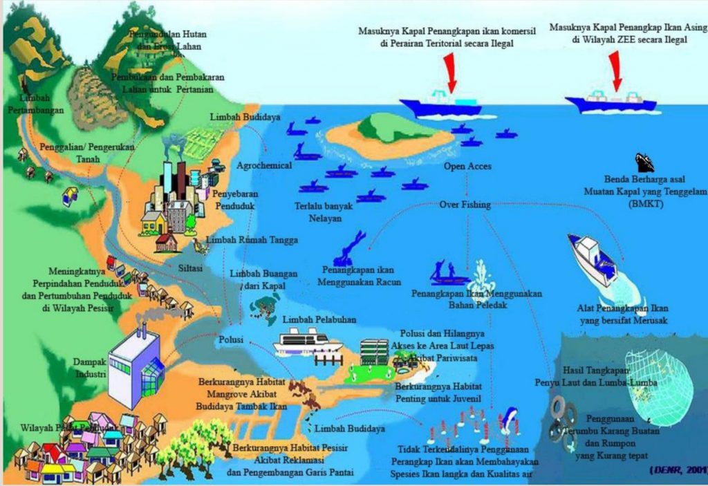
Coastal areas have a variety of potential that can be utilized as a tourist and economic attraction. With this data, it will produce benefits in coastal areas and small islands, including:
Identify suitable areas for use,
encouraging the use of space and resources,
identify ecologically important areas,
guarantee and ensure the allocation of space for biodiversity and nature conservation,
encouraging opportunities for communities to participate in development,
reducing the possible negative impacts of resource use,
protecting space that has been used for generations for the social and cultural interests of the community, such as for traditional ceremonies, tanah ulayat (a plot of land on which there is the right of authority of a certain customary law community), local sacred areas,
reducing space use conflicts, both between incompatible uses and conflicts between human use and the preservation of the natural environment.